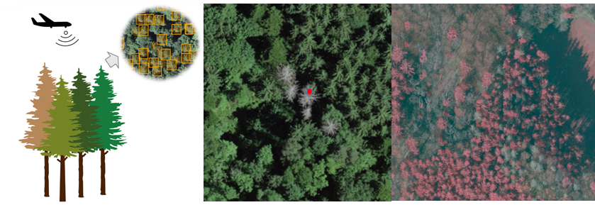
Assessing spruce mortality in mixed forests using RGBI aerial imagery and deep learning (M.Sc. Topic)

Background: Climate change-induced drivers such as drought and biotic infestations are leading to increased tree mortality worldwide. However, our knowledge of automatic detection of tree mortality is limited mostly due to data availability and the use of approaches that have low transferability. Despite an urgent need for forestry professionals to quickly identify tree mortality, methodical approaches are quite limited and are used mainly on local scale. Latest developments in remote sensing data availability allow us to tackle this challenge and accurately assess the vegetation condition at different spatial and temporal scales.
Aim: This work aims to develop an approach for the detection of spruce mortality in mixed forests using true color near-infrared RGBI aerial imagery and deep learning.
Methods: Field inventories (e.g. trees affected by bark beetle infestation) and RGB imagery will be integrated and analyzed using R or ArcGIS Pro.
Wanted: A highly motivated students interested in remote sensing and GIS and willing to learn new practical techniques and ecological concepts.
You will get to:
- Learn where and why trees die and, more importantly, how to identify tree mortality in the face of climate change;
- Get familiar with the latest developments in remote sensing data processing and analyzing;
- Gain important statistical knowledge for future work;
- Expand your network by discussing your work with experts from the intersecting fields of forest sciences, and computer sciences;
- Be a co-author on a publication resulting from this work;
- Be part of a motivated, fun, and energetic team of scientists.
Supervisor: Dr. L. Waser (WSL) and Dr. M. Beloiu
The project has a flexible starting date.
If the idea of participating in cutting-edge interdisciplinary research excites you, please contact mirela.beloiu(at)usys.ethz.ch. The FORM team is looking forward to hearing from you!