TreeAI Global Initiative
Welcome to TreeAI - Advancing Tree Species Identification from Aerial Images with Deep Learning
Introduction
The TreeAI Global Initiative is a groundbreaking initiative to assess tree species diversity using high-resolution aerial images and computer vision approaches. TreeAI brings together the first global database for tree species annotation and high-resolution aerial images and deep learning models for individual tree species and tree mortality identification.
Objective
The primary goal of the TreeAI global initiative is to:
- Create a global database for tree species and tree mortality annotation and high-resolution aerial images.
- Develop robust and generalizable computer vision models for tree species identification in sub-meter resolution aerial imagery.
- Advance biodiversity monitoring through more accurate AI-based solutions for forest mapping.
- Foster interdisciplinary collaboration among data scientists, ecologists, and remote sensing experts.
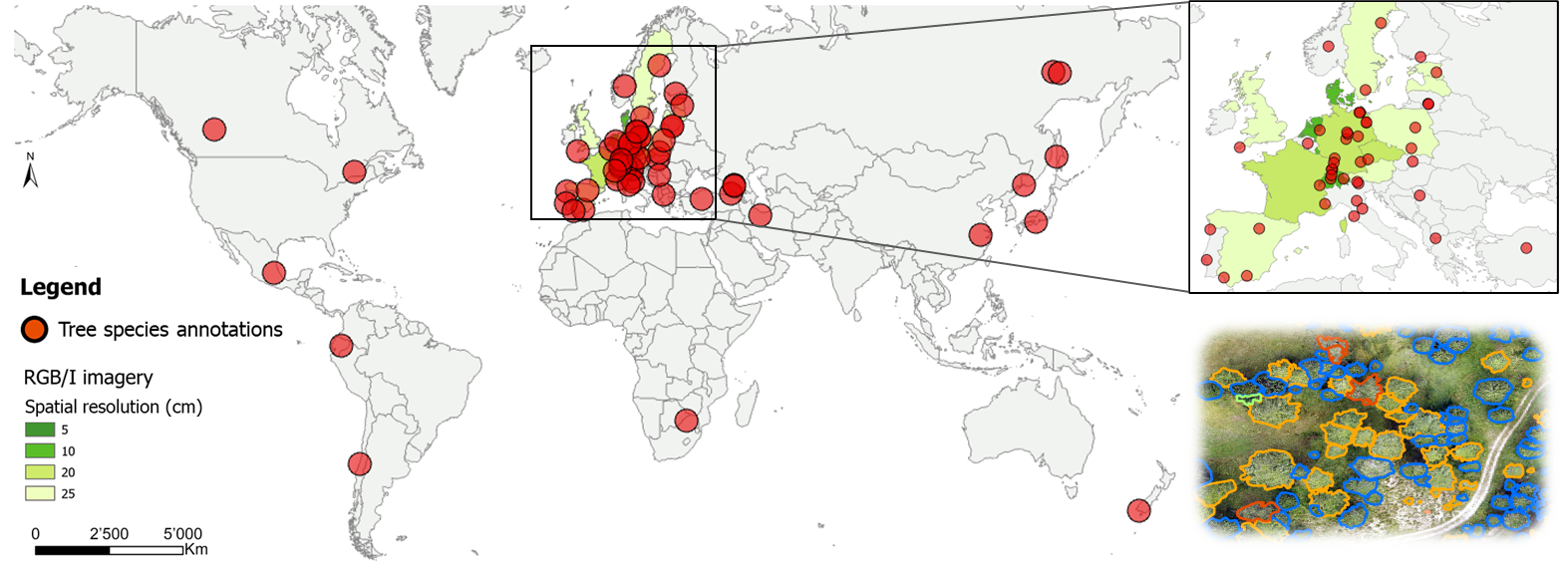
Dataset map
Your dataset might be the next red dot! Share your images through our Data Call.
We currently have RGB/I images and the corresponding tree species annotations from the sites represented by a red dot on this map.
Consortium
- Dr. Mirela Beloiu Schwenke, Zhongyu Xia, Prof. Verena Griess (ETH Zurich)
- Dr. Martin Mokros (University College London)
- Prof. Xinlian Liang (Wuhan University)
- Dr. Stefano Puliti (Norwegian Institute of Bioeconomy Research)
- Dr. Lars Waser, Dr. Natalia Rehush, Prof. Arthur Gessler (WSL Switzerland)
- Prof. Teja Kattenborn (University of Freiburg)
- Clemens Mosig (University of Leipzig)
- Yan Cheng (University of Copenhagen)
Contact
Zhongyu Xia, zhongyu.xia[at]usys.ethz.ch
Dr. Mirela Beloiu Schwenke, mirela.beloiu[at]usys.ethz.ch