Virtual Forest (2021-2025)
Creating a virtual forest based on information obtained via terrestrial and airborne 3D scans
Description:
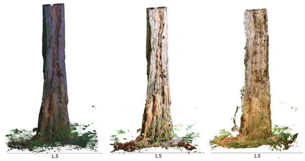
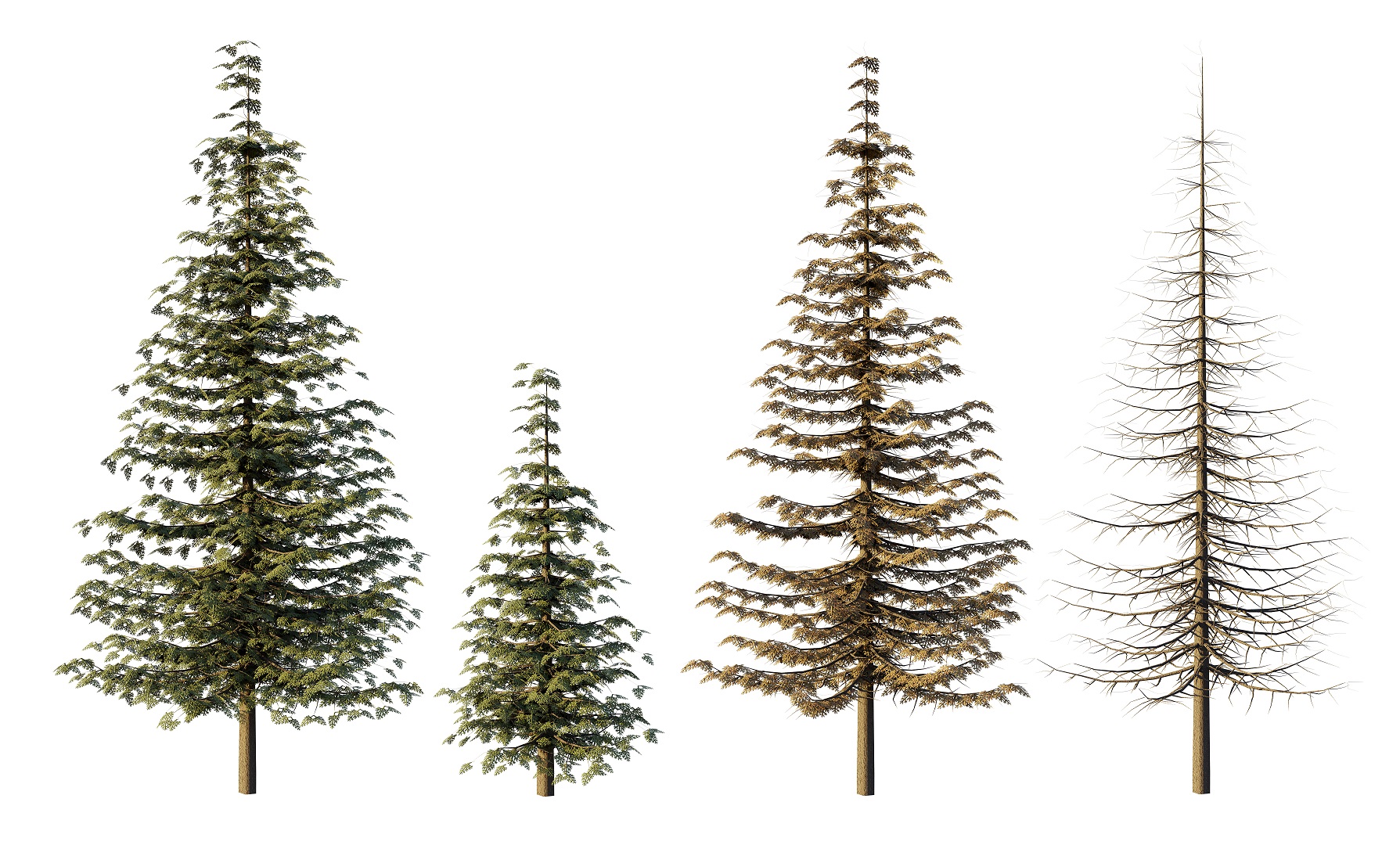
In this project we are developing the building blocks required to create a virtual forest based on information obtained via terrestrial and airborne 3D scans. The work aims to create an integrated information system for forests. In this regard, we investigate the whole range of the workflow both from the technical and human interaction aspects: data acquisition (photogrammetry, lidar, and low-cost alternatives), data processing, and data visualisation (VR, AR, and MR). These building blocks will eventually be linked with landscape level planning tools, allowing to showcase future forest structures and characteristics depending on various forest management scenarios as well as changing environmental conditions. Findings will enhance our understanding of the forest structures and characteristics required to provide specific ecosystem services, and will facilitate communication between science, industry, and the general public.
Principal Collaborators:
- Dr. Arnadi Murtiyoso, ETH Zurich
- Cyprien Fol, ETH Zurich
- Michelle Weber, Zürcher Hochschule der Künste (ZHdK)
Students:
- Lina Muntwyler (BSc thesis, 2023)
External partners (joint research and papers):
- Swiss Federal Institute for Forest, Snow and Landscape Research WSL
- Yasuaki Kakehi Laboratory, University of Tokyo
- 3D Optical Metrology, FBK Trento
- 3DForEcoTech COST Action
Publications:
- Fol, C.R., Zhao, J., Späth, L. et al. external page Advancing forest biodiversity visualisation through mixed reality. Sci Rep 15, 15908 (2025).
- Fol, Cyprien R. (2025). "3D Spatial Mapping and Immersive Visualisation of Forest Biodiversity." Doctoral Thesis, ETH Zurich, Zurich.
- Murtiyoso, Arnadi, Cabo, Carlos, Singh, Arunima, Pereira Obaya, Dimas, Cherlet, Wout, Stoddart, Jaz, Fol, Cyprien R., Beloiu Schwenke, Mirela, Rehush, Nataliia, Sterenczak, Krzysztof, Calders, Kim, Griess, Verena and Martin Mokros. (2024). "external page A Review of Software Solutions to Process Ground-based Point Clouds in Forest Applications." Current Forestry Reports 10.6: 401-419.
- Fol, Cyprien R., Shi, Nianfang, Overney, Normand, Murtiyoso, Arnadi, Remondino, Fabio and Verena Griess. (2024). "external page 3D dataset generation using virtual reality for forest biodiversity." International Journal of Digital Earth 17.1: 2422984.
- Hu, Youyang, Fol, Cyprien R., Chou, Chiaochi, Griess, Verena and Yasuaki Kakehi. (2024). "external page Immersive Flora: Re-Engaging with the Forest Through the Visualisation of Plant-Environment Interactions in Virtual Reality." In CHI EA '24: Extended Abstracts of the CHI Conference on Human Factors in Computing Systems, ed. Mueller, Florian Floyd, Kyburz, Penny, Williamson, Julie R., Sas, Corina, Wilson, Max L. and et al., 407 New York, NY: Association for Computing Machinery.
- Qureshi, Abdul Hannan, Alaloul, Wesam Salah, Murtiyoso, Arnadi, Hussain, Syed Jawad, Saad, Syed and Muhammad Ali Musarat. (2023). "external page Automated Scaling of Point Cloud Rebar Model via ArUco-Supported Controlled Markers." Journal of Construction Engineering and Management 150.3: 04023170
- Murtiyoso, Arnadi, Markiewicz, Jakub Stefan, Karwel, Artur Karol, Grussenmeyer, Pierre and Patryk Kot. (2024). "external page Comparison of state-of-the-art multi-view stereo solutions for close range heritage documentation." In International Archives of the Photogrammetry, Remote Sensing and Spatial Information Sciences, ed. Campana, S., Fassi, F. and Remondino, F., 317-323. Göttingen: Copernicus.
- Hristova, Hristina, Murtiyoso, Arnadi, Kükenbrink, Daniel, Marty, Mauro, Abegg, Meinrad, Fischer, Christoph, Griess, Verena and Nataliia Rehush. 2024. "external page Viewing the Forest in 3D: How Spherical Stereo Videos Enable Low-Cost Reconstruction of Forest Plots." IEEE Journal of Selected Topics in Applied Earth Observations and Remote Sensing 17: 17612-17625.
- Murtiyoso, Arnadi, Holm, Stefan, Riihimäki, Henri, Krucher, Anna, Griess, Holger, Griess, Verena and Janine Schweier. (2023). "external page Virtual forests: a review on emerging questions in the use and application of 3D data in forestry." International Journal of Forest Engineering 35.1: 29-42.
- Fol, Cyprien R., Murtiyoso, Arnadi, Kükenbrink, Daniel, Remondino, Fabio and Verena Griess. (2023). "external page Terrestrial 3D Mapping of Forests: Georeferencing Challenges and Sensors Comparisons." In The International Archives of the Photogrammetry, Remote Sensing and Spatial Information Sciences, ed. Hejmanowska, B., Iwaszczuk, D., Bakuła, K. and Remondino, F., 55-61. Hannover: International Society for Photogrammetry and Remote Sensing (ISPRS).
- Fol, Cyprien R., Kükenbrink, Daniel, Rehush, Nataliia, Murtiyoso, Arnadi and Verena Griess. (2023). "external page Evaluating state-of-the-art 3D scanning methods for stem-level biodiversity inventories in forests." International Journal of Applied Earth Observation and Geoinformation 122: 103396.
- Weber, M. S. (2023), 3D Tree Model Creation – Process Documentation. Internship report.
- Murtiyoso, A., Hristova, H., Rehush, N., and Griess, V. (2022). Low-cost Mapping of Forest Under-storey Vegetation Using Spherical Photogrammetry, Int. Arch. Photogramm. Remote Sens. Spatial Inf. Sci., XLVIII-2/W1-2022, 185–190.
- Fol, C. R., Murtiyoso, A., and Griess, V. C. (2022). Feasibility Study of Using Virtual Reality for Interactive and Immersive Semantic Segmentation of Single Tree Stems, Int. Arch. Photogramm. Remote Sens. Spatial Inf. Sci., XLVIII-2/W1-2022, 95–99.
- Fol, C. R., Murtiyoso, A., and Griess, V. C. (2022). Evaluation of Azure Kinect Derived Point Clouds to Determine the Presence of Microhabitats on Single Trees Based on the Swiss Standard Parameters, Int. Arch. Photogramm. Remote Sens. Spatial Inf. Sci., XLIII-B2-2022, 989–994